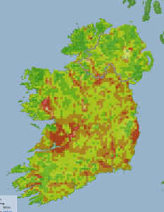
 A new initiative to help authorities make informed decisions about landscape conservation for Ireland’s bat species was launched in Dublin earlier this week by Dr Liam Lysaght, director of the National Biodiversity Data Centre (NBDC).
A joint project by Bat Conservation Ireland (BCI) and the Centre for Irish Bat Research (CIBR), the “‘Landscape Conservation for Irish Bats’” initiative stems from the correlation of BCI’s bat records from all over Ireland with knowledge about each bat species’ preferred habitat, and actual conditions on the ground where those species are known to occur.
By exploring criteria like land cover, altitude, climate and other information, and overlaying sightings record data, the scientists could determine crucial information that will feed in to future conservation efforts.
Key outputs of the report include:
- The geographical areas that are suitable for the nine different bat species
- The core favourable area for each species
- The role that habitat plays in roost selection
- The building features that play a role in roost selection
Overall the report identified that Ireland has the potential to be bat-friendly, with suitable habitat and roosting sites available throughout the country.
You can download a PDF version of “Landscape Conservation for Irish Bats” by clicking on the link (opens a PDF document — to download right click and “save as”).
The “Landscape Conservation for Irish Bats” project was jointly funded by Bat Conservation Ireland, The Northern Ireland Environment Agency (NIEA) and 20 local authorities around Ireland: Clare, Donegal, Dún Laoghaire-Rathdown, Galway, Kerry, Kildare, Kilkenny, Laois, Longford, Louth, Mayo, Meath, Monaghan, Offaly, Roscommon, Sligo, South Dublin, Waterford, Wexford and Wicklow.
As well as the reports, maps from the study went live on the National Biodiversity Data Centre’s online mapping system, Biodiversity Maps, where the information will be available for consultation by conservation decision makers.


